Welcome to the Guadalupe Mountains
Megan Levine – Sedimentary Rocks and Processes- Fall 2019
Saturday, September 21, 2019: Washington Ranch Riverbed
Geographic Location : 32° 6′ 58″ N , 10° 27′ 11″ W Elevation: 3600 ft
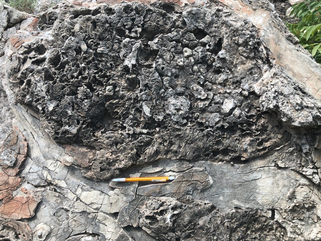
Washington Ranch is located just west of Guadalupe Mountains National Park and is where we stayed while we were exploring the area. Because there is no rest for a geologist, since geology is all around us, our first stop was on site at the ranch. We were shown a natural dam that was generated by water coming from Rattlesnake Spring. Rain falling on the nearby Guadalupe Mountains dissolves calcareous material which then flows down into the spring and is deposited into the dam. This coats everything in calcium carbonate (CaCO3). This deposition and coating forms calcareous tufa, which is terrestrial limestone. This limestone was precipitated from the spring when it is supersaturated in CaCO3. The huge amounts of CaCO3 precipitating out of the water coats EVERYTHING, including any vegetation present, preserving them moderately well. The carbon dioxide (CO2) degassing from this process causes CaCO3 to precipitate faster which is how the natural dam here formed.
Sunday, September 22, 2019 : Bottomless Lakes Stop 1- Lea Lake
Geographic Location: 33° 19′ 14″ N , 104° 19’44″W Elevation: 3550 ft
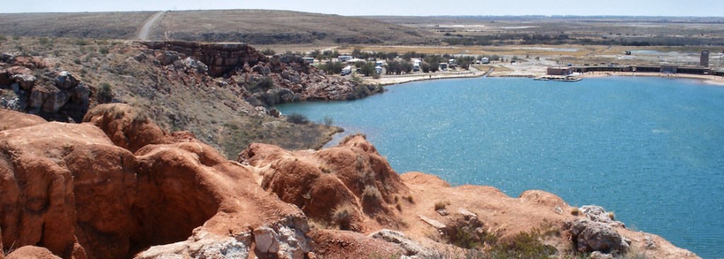
We spent the majority of Sunday exploring the Bottomless Lakes area, which was named because at the time they were discovered the bottom could not be reached.
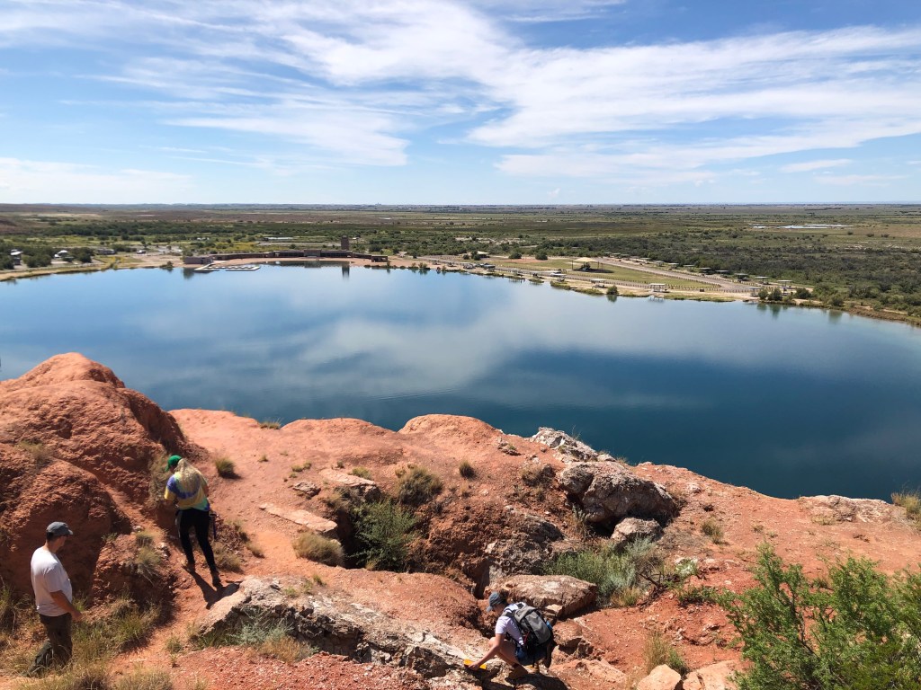
Essentially Lea Lake, along with several of the other lakes in this cluster, is a large sinkhole that has been filled in with water from rain runoff, springs, and underground artesian activity. The mineralogy here is composed of clays, gypsum, anhydrite (indicating periods with a lack of water), shales, and lots of iron which is obvious by the reddish-orange coloring that is predominant here. The iron shows up in sandstone, siltstones, and clay rocks. The bottomless lakes formed when the Delaware Basin started to sink during the Permian period (~270-250 mya). When the basin began to sink, there were areas that remained shallow allowing for evaporation of water and therefore evaporites to precipitate and deposit. Most of the evaporites here are from after the Permian period and are actually from the Artesia Group (~230 mya), with four different units present.
The gypsum and anhydrite deposits (crystals) here are white, powdery, soft, and brittle . Secondary crystals precipitated in clays and on cavity walls.
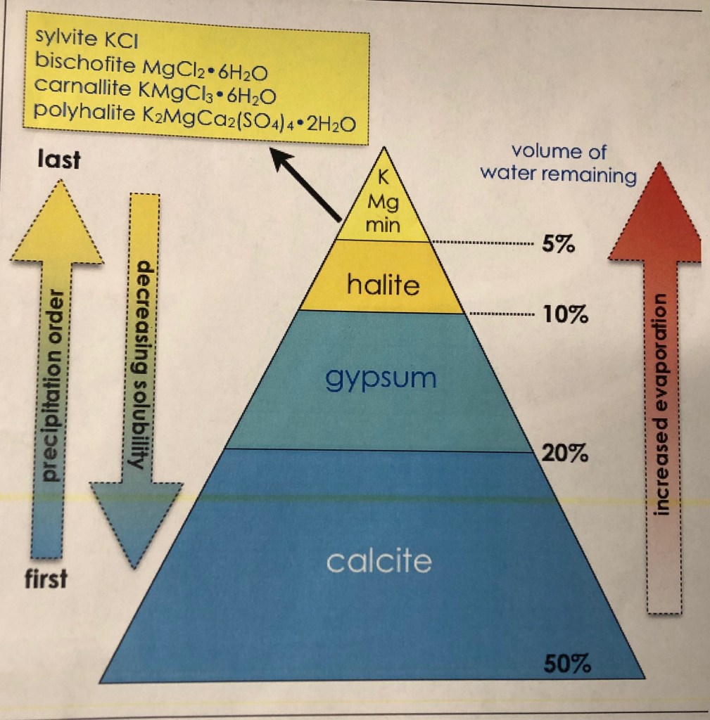
The chart above shows the order in which evaporite minerals with precipitate out of a body of water. To summarize it, calcite will precipitate first, then gypsum and anhydrite, next halite, and last salts like sylvite(KCl) or MgCl. This means that the salts and halite will dissolve easily and quickly after simple events such as a heavy rain. An important note is that in shallow marine environments, plant life produces gypsum so when the basin or lagoon is cut off from the water source salinity will rise. This would have been the case in the Delaware Basin. The salinity will continuously rise allowing for the more soluble minerals to eventually precipitate.
On the west side of Lea Lake, and surrounding several other lakes here, is a large escarpment. An escarpment is a band or formation of raised rock. They are caused by collapses usually due to rain and weathering mechanisms. They are fairly common around sinkholes and evaporite production environments because those minerals are sometimes unstable, especially in wet environments.
Also present at Lea Lake are Quaternary alluvial sediments most likely transported by the Pecos River.
Sunday, September 22, 2019 : Bottomless Lakes Stop 2- Lazy Lagoon
Geographic Location: 33° 21′ 9″ N , 104° 20′ 22″ W Elevation: 3520 ft
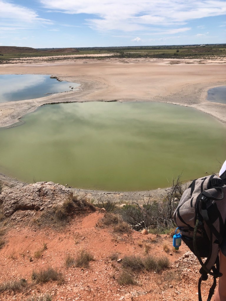
The second stop of the day was at Lazy Lagoon, which on Sunday was several small lagoons because the water levels were so low that the small bodies of water had become disconnected. At other times of the year, when the water levels are higher, it is one large lagoon. As the picture above illustrates, the small lagoons are different colors, with the one in the foreground being much greener than the other two, which are bluer. There are several possible reasons for the color changes including mineral, chemical, depth, water source, sediments, and biological differences. Like Lea Lake, Lazy Lagoon is a restricted lagoon/basin, meaning it has been cut off from a water source. So today, it is occasionally replenished by rain, runoff, artesian activity, and the rare but possible flood event. During times of high evaporation, the salinity levels climb so high that it kills surrounding vegetation including trees. When it hasn’t rained for a time, there are visible salt precipitations/coatings present.
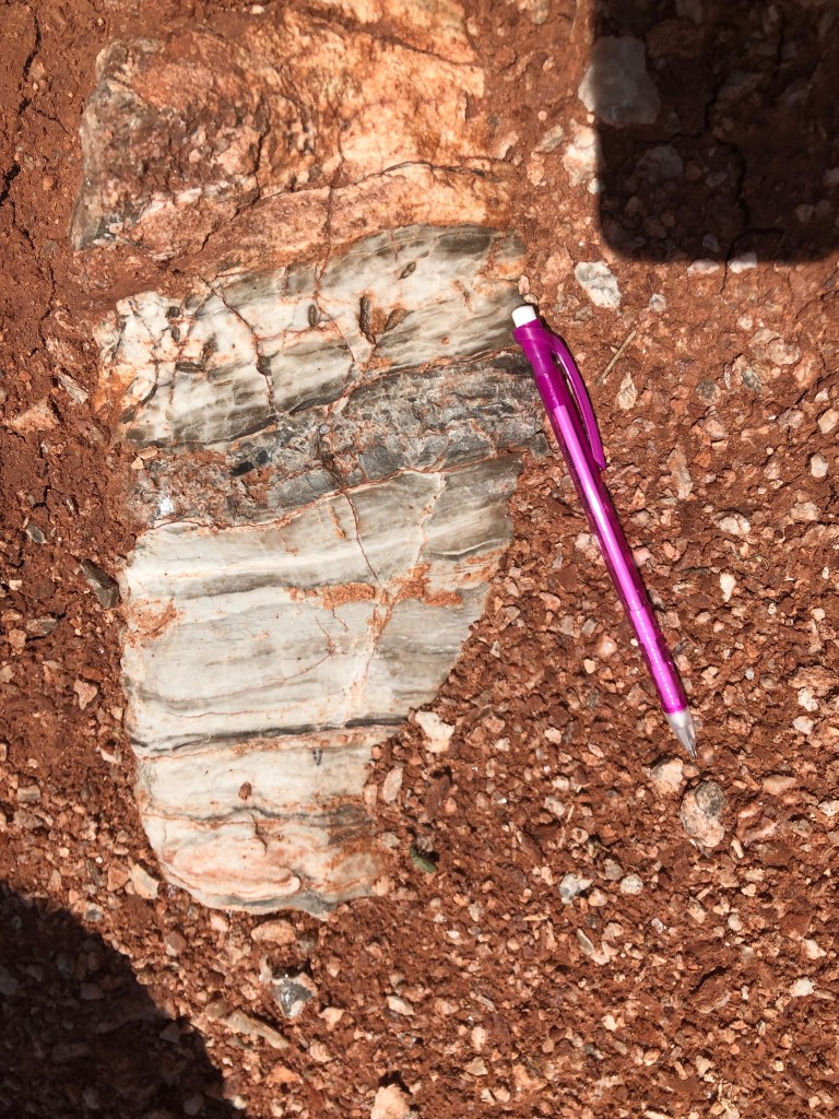
Present in the rocks above and surrounding Lazy Lagoon were small outcrops of gypsum/anhydrite, calcite, sandstones, and siltstones. These minerals most likely precipitated out of the lagoons and formed the rocks that we seen today
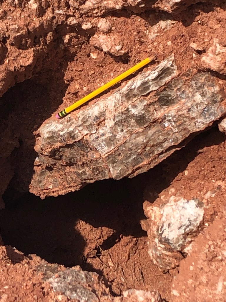
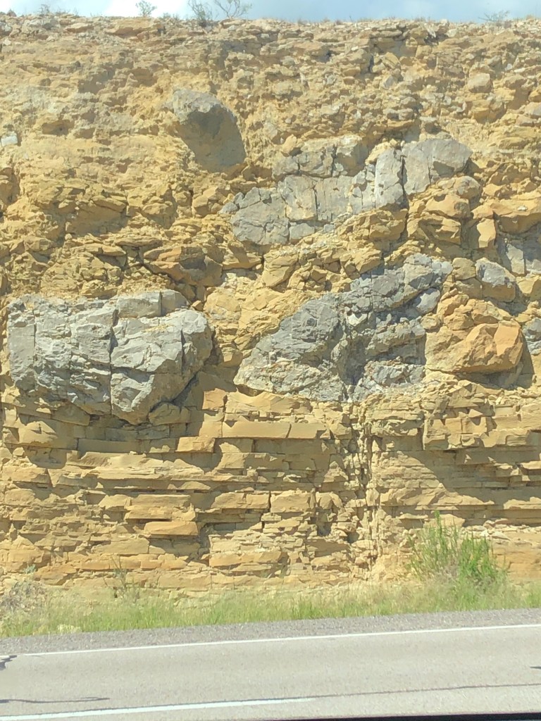
Closer to the roadside, larger outcrops of sandstones containing the evaporite minerals were found such as the one pictured above.
Sunday, September 22, 2019 : Bottomless Lakes Stop 3- Devil’s Inkwell
Geographic Location: 30° 20′ 19″ N , 104° 20′ 3″ W Elevation: 3560 ft
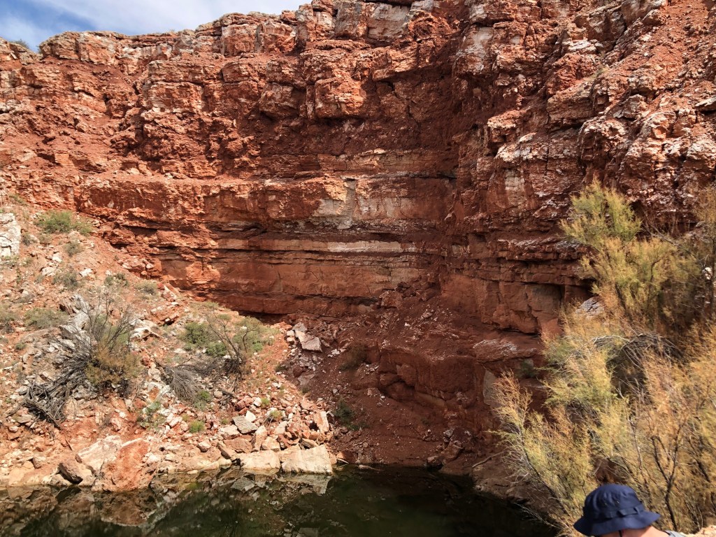
Contrary to Lea Lake, Devil’s Inkwell is a collapse. The name is because of the darker colored waters than the other lakes and it has the steepest sides. The dark green color of the water is due to algae and other aquatic plants that are growing on the bottom. Officially, Devil’s Inkwell is a cenote, which is a naturally occurring crater that is formed by a collapse of the limestone bedrock underneath. This is also associated with underlying groundwater being exposed. There is evidence of slow sinking, suggesting a collapse over a period of time rather than all at once. Also observed at Devil’s Inkwell are gypsum layers as well as clay/siltstone layers. The latter of which is an aquitard which keeps the water from flowing out of the pit.
Sunday, September 22, 2019 : Bottomless Lakes Stop 4- Twin Lake (Figure 8 Lake)
Geographic Location: 134° 20′ 15″ N , 104° 19′ 58″ W Elevation: 3480 ft
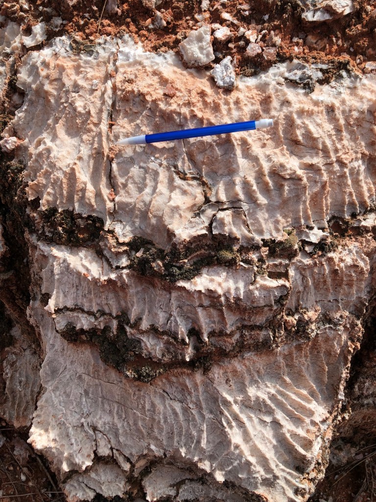
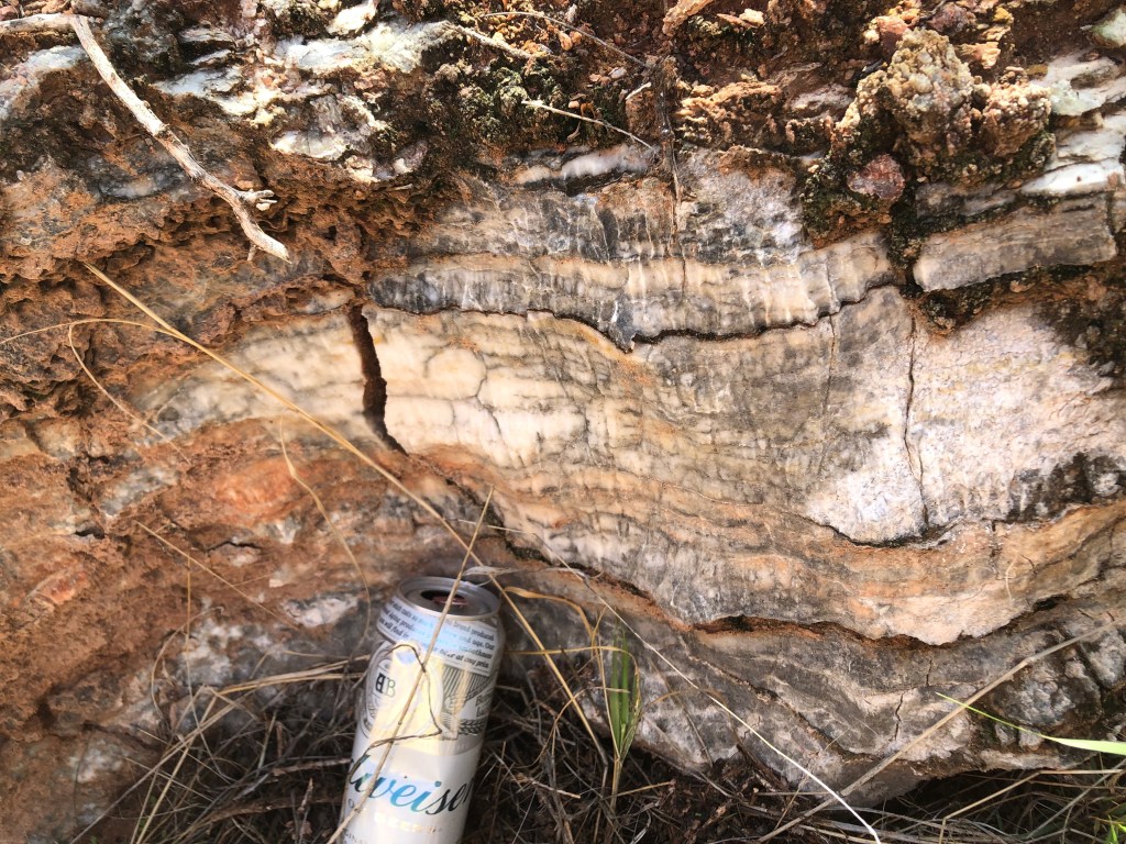
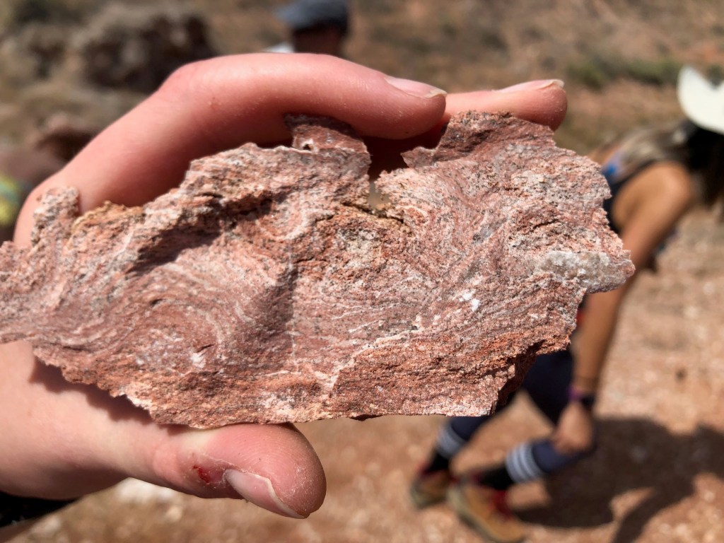
The most important feature we observed at Twin Lakes are the Karren formations (pictured above). These Karren are formed mostly from Gypsum as water and carbonic acid flows over evaporite formations. Karren take only weeks to years to form meaning that they can both form and disappear quickly. They are conduits forming by flowing water. For Karren to form in limestones you also need carbonic acid to be present. Here however, there is only evaporite minerals so to form or destroy these features you only need water because of the water content already in gypsum.
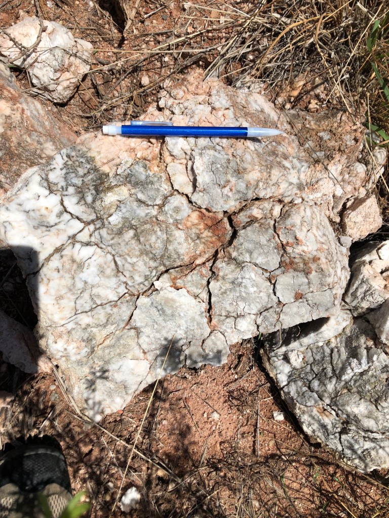
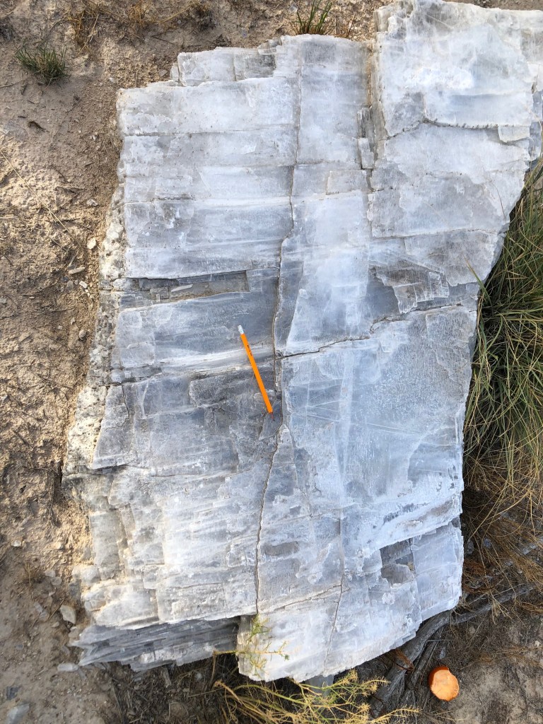
Sunday, September 22, 2019 : Stop 5- Selenite Mine
Geographic Location: 32° 2′ 42″ N , 104° 27′ 50″ W Elevation: 3820 ft
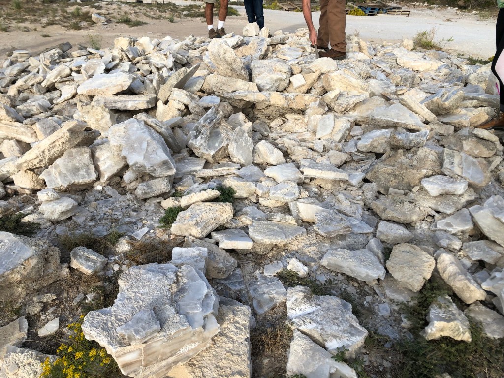
This stop was almost right across the street from Washington Ranch. Here we found a ridiculous amount of raw gypsum species, mostly selenite. The selenite is white-transparent with laminar growth and three axes of cleavage. It was found both in the pile pictured above and embedded in the ground. The pieces varied in size from a few centimeters to almost a meter long. The other type of gypsum we found was alabaster which is white and opaque with a granular texture and no distinguishable cleavage.
Monday September 23, 2019 : Road Stop 1- Salt Flat Balsam
Geographic Location: 31° 45′ 17″ N , 104°59′ 2″ W Elevation: 3590 ft
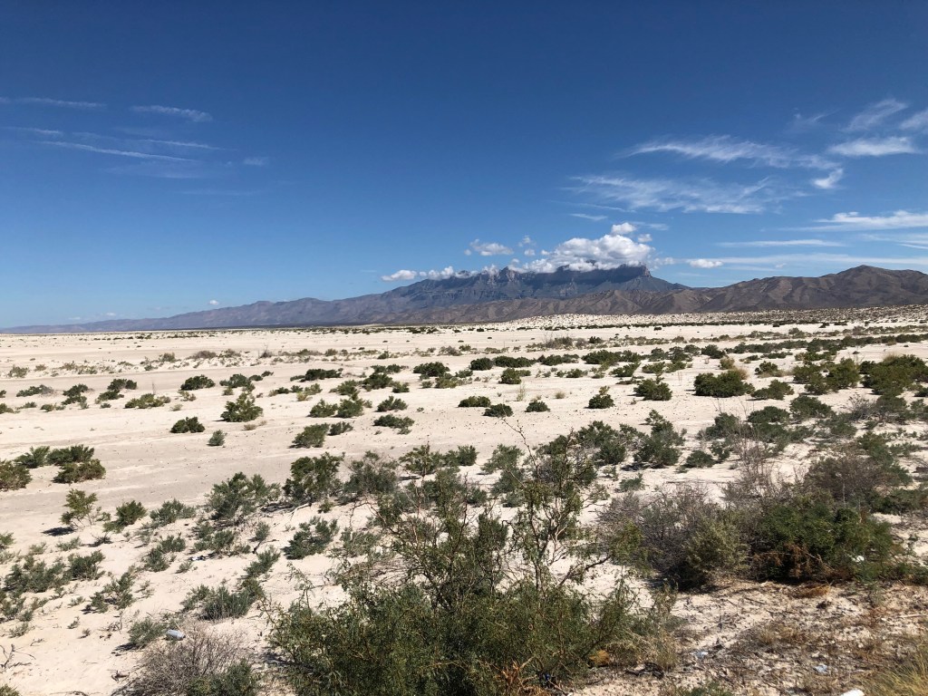
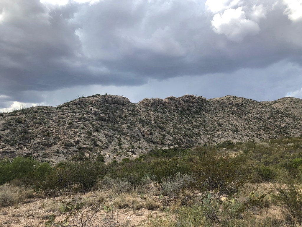
The first stop Monday morning was the Salt Flat Balsam. We were in the eastern most part of the basin with the Guadalupe Mountains surrounding the salt flats to the northeast and Diablo Plateau to the southwest. Since we were in a flat area with mountains on either side, we can deduce that this is a horst and graben formation (pictured below). The mountains are the horst sections while the salt flat is the graben. This is a major fracture/fault system that is most likely still active.
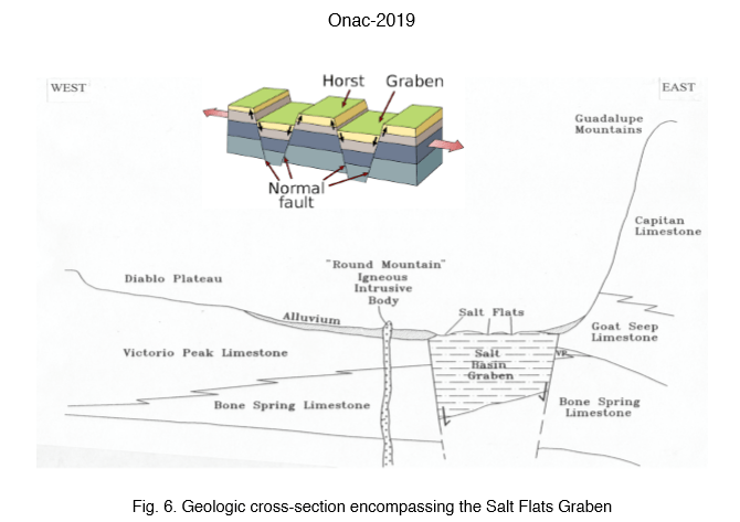
The main mineral present in the salt flat is halite with some gypsum present. There are gypsum and alluvial dunes to the southeast. Halite most likely formed directly in the graben while gypsum and CaCO3 was brought down from the surrounding mountains by rain runoff. The depressions that are seen are also formed by rain running down the sides of the mountains. The sloping sides on the Guadalupe Mountains have sandstone deposits with limestone beds in between. El Capitan is visible and because we know that it is in the forereef, we also know it is Cherry Canyon Sandstone. Another important feature that was observed was mud cracks which indicate that wetting/drying mechanisms are taking place. There are also small, black anthropogenic rocks scattered about.
Monday September 23, 2019 : Road Stop 2- Organic Limestone
Geographic Location: 31° 48′ 58″N , 104° 49′ 43″ W Elevation: 4340 ft
The rocks at this stop are all sedimentary and are brittle with lots of cracks and fractures. The layering is thin with many broken layers, while the top layers are slightly thicker than the layers towards the bottom. This is most likely due to the area being tectonized with lots of movement due to a fault. The host rock is limestone that has been impregnated with organic material. The black overall color of the rocks is from this organic material. This could be or potentially create oil. There is calcite present that precipitated secondary, filling in veins and cracks. Keeping in mind that there is lots of sandstone around, the white minerals are possibly quartz.
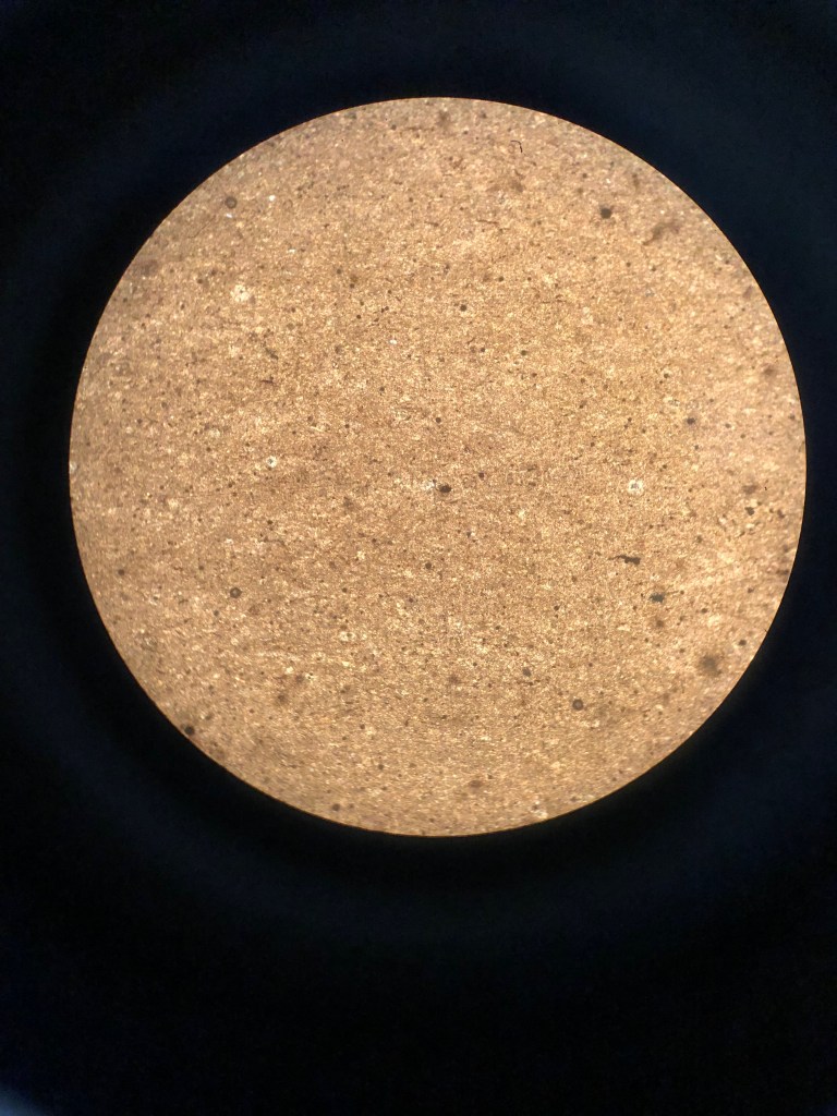
Once under a microscope the limestone is confirmed to be an orthochem-classified rock, being composed almost completely of micrite. Most of this rock is just CaCO3 as is all limestone, with organic enrichments. Also visible are the secondary calcite crystals and tiny quartz crystals which were identified by their extinction patterns. I would say this rock is between 85-90% micrite with calcite making up 5% and quartz making up another 5%. The rock is moderately sorted, mostly tiny micritic crystals with some larger, darker objects, most likely organic matter, and some small calcite and quartz crystals.
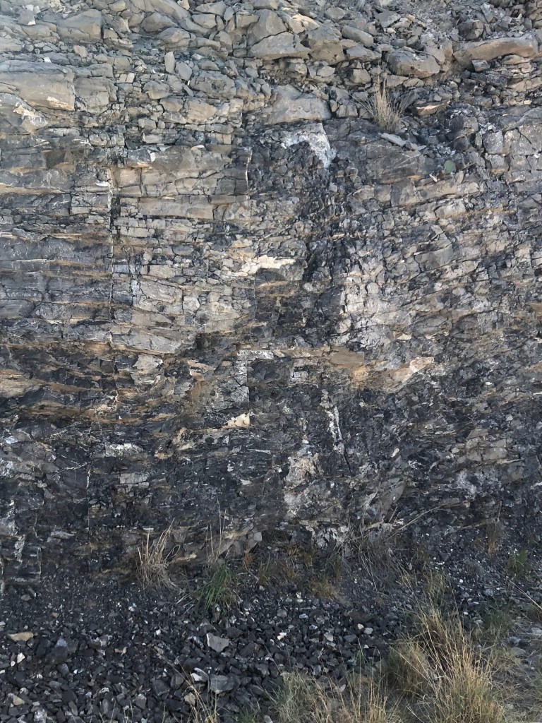
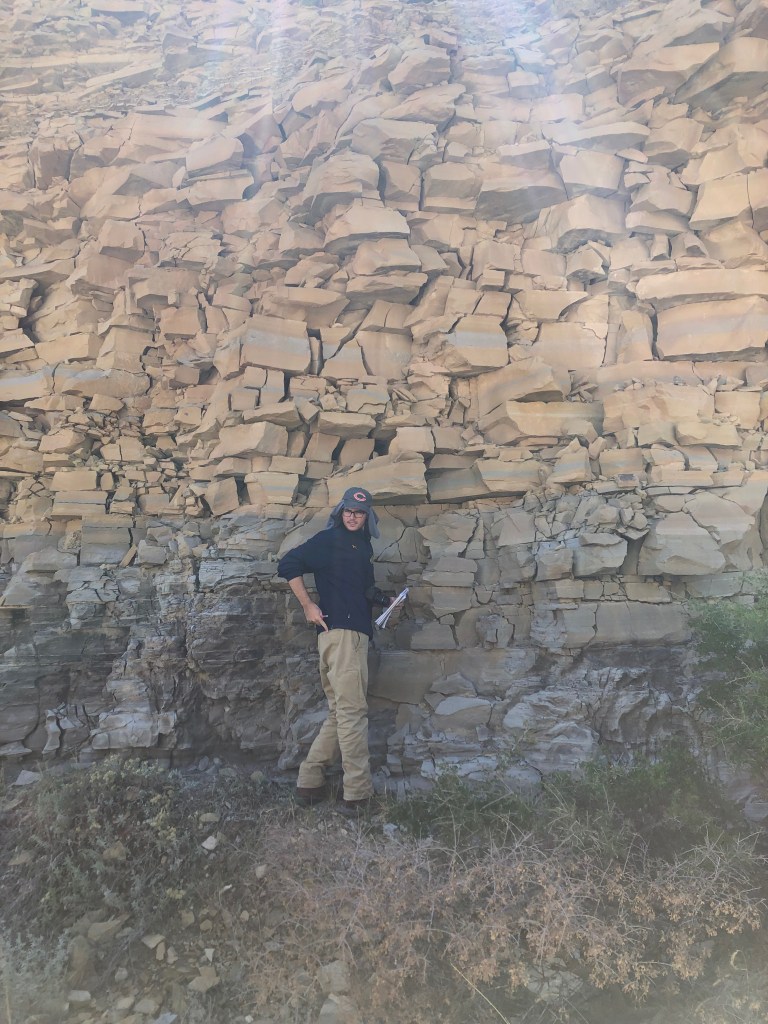
Monday September 23, 2019 : Road Stop 3- Brushy Canyon Channel
Geographic Location: 31° 50′ 53″ N, 104° 50′ 23″ W Elevation: 4670 ft
The contact point between the Brushy and Cherry formations here is quite obvious. The top (Cherry) formation is light brown/tan with thick layers made of sandstone. The bottom (Brushy) formation has gray/ dark brown, thinner, and more cracked layers most likely siltstones and shales. The bottom formation’s layers also have bends in them that are channel deposits that are usually formed at submarine fans. This is evidence that the two formations were formed at different times and in different environments. The Brushy formation formed first at fan lobes while the Cherry sandstones formed later as channel-sands.
In this picture above, we can see the Brushy fan channel cutting into and subsequently dipping beneath the Cherry formation sandstone. In this section we can actually see the several layers and flows of the channel consolidating into one channel and injecting downward.
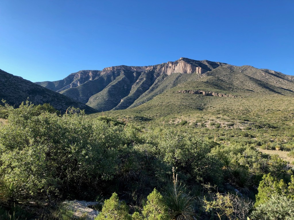
Monday September 23, 2019 : Road Stop 4- El Capitan
Geographic Location: 31° 51′ 16″ N , 104° 50′ 41″ W Elevation :4640 ft
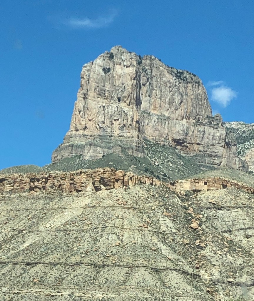
El Capitan itself is from the forereef of the prehistoric coral reef. It composed of the white limestone formation in the top half of the peak picture above. This limestone is the top-most section of the Bell Canyon Formation. Below the limestone formation there are two major sandstone units; Cherry Canyon and Brushy Canyon. Below the Bell Canyon is the Cherry Canyon sandstones. They are usually red in color and are formed from channel-sands. Underneath the Cherry Canyon lies the Brushy Canyon Formation sandstones. They are usually beige to gray in color and are formed from sands deposited from marine fan lobes. This formation is also less permeable than the two above it. The limestone outcrop on the side of El Capitan is caused by resistance to weathering because the minerals present are stable at surface conditions. These minerals are stable at the surface because this is where they originally form. These three main units seen at El Capitan can be seen throughout much of the Guadalupe Mountains.
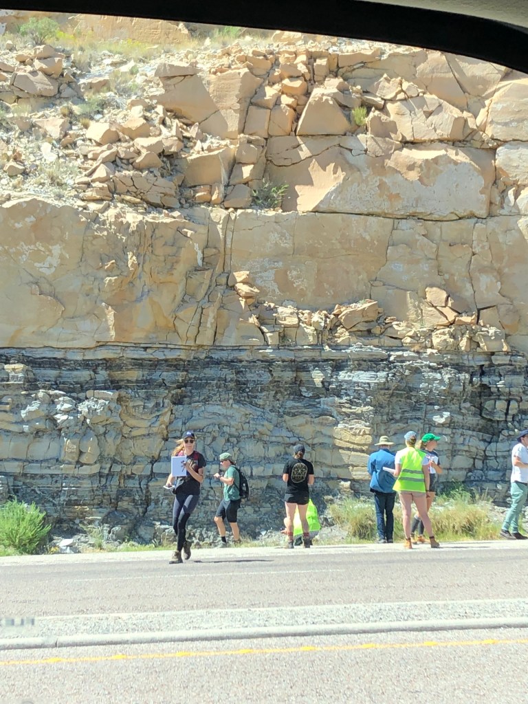
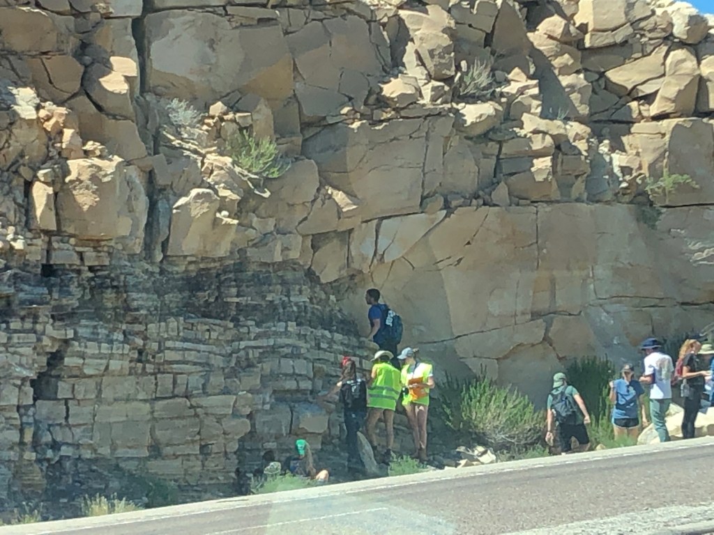
Monday September 23, 2019 : Road Stop 5- Cherry Enigma
Geographic Location: 31° 51′ 16″ N, 104° 50′ 41″ W Elevation: 4940 ft
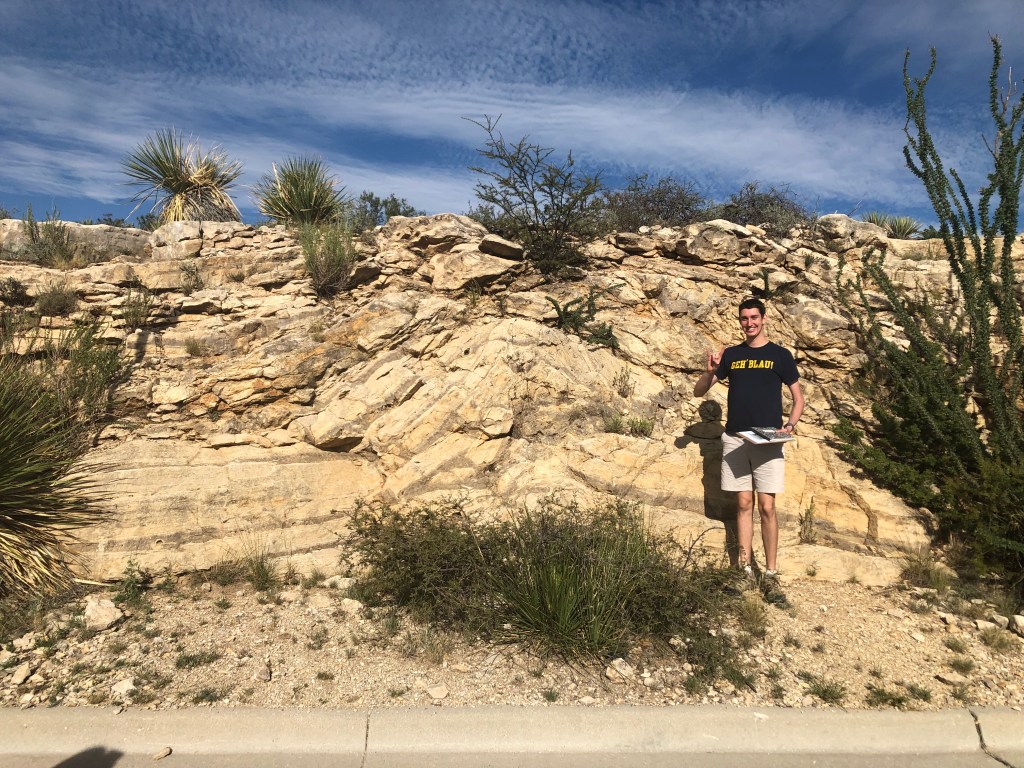
This stop is a clear boundary between the Cherry and Brushy Formations, with the boundary being right about where Evan’s head is. As before the Cherry Canyon sandstones are on top and as always they are lighter in color, red-orange/tan. In this Cherry Formation there are small grey laminations and ripples throughout which are not commonly found in the Delaware Basin (hence enigma). The boundary between the two layers is a dark gray color and about 2-3 feet wide. As proven before, the Cherry is the younger formation because it is on top following the law of superposition.
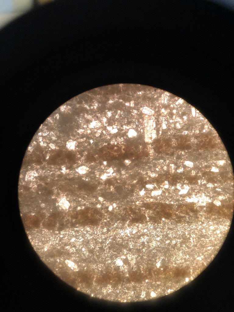
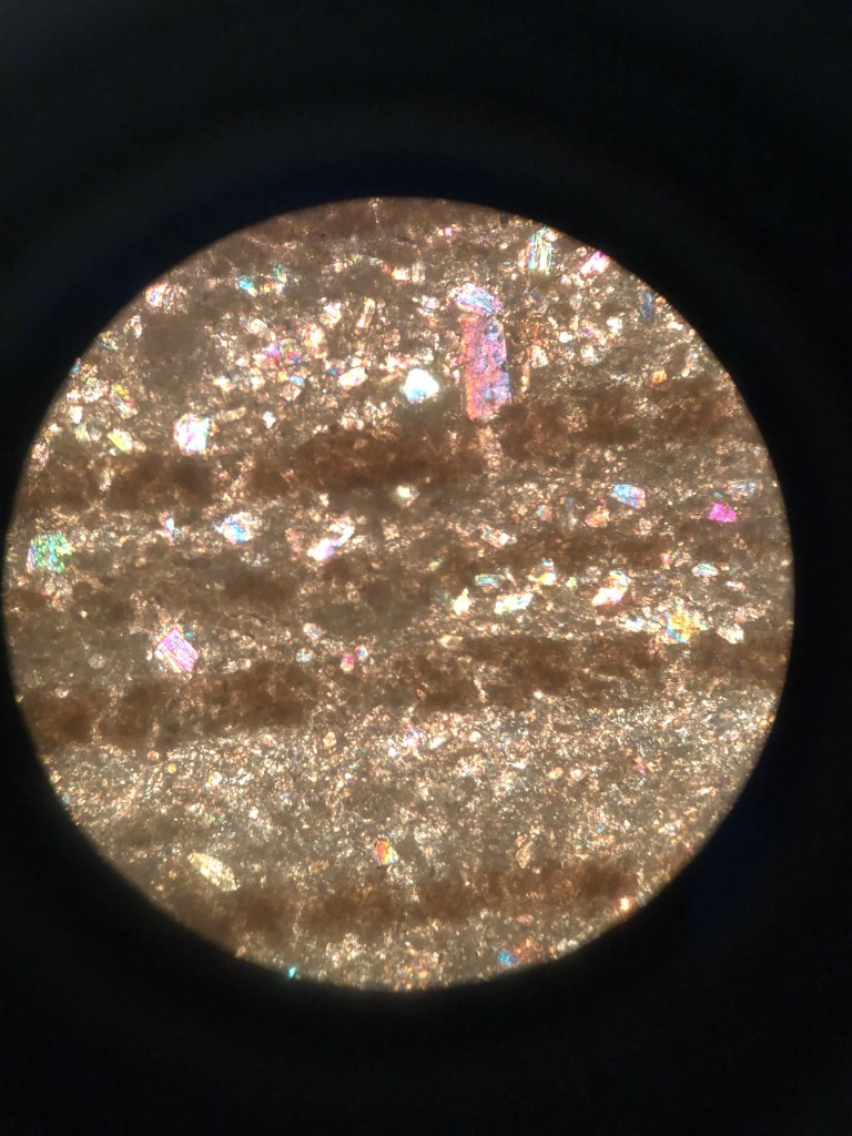
In the above thin section of a Cherry Canyon Sandstone we can see that the dominant mineral present is quartz. The rock is completely micritic with so phenocrysts present, only small crystals. There are other minerals present as well such as feldspar, calcite, and possibly gypsum. These minerals are identified under crossed polarized light by there interference colors and cleavage planes. The mineral grains in this rock are well sorted but pretty angular. The quartz can be identified by the black/gray/white extinction patterns and the lack of any structure or cleavage in any of the grains. Considering this is a sandstone, the rock being entirely quartz is normal and understandable, especially because these sandstones formed in a marine environment. However, the grey ripples seen in the Cherry outcrop cannot be seen in this specific thin section.
In the Brushy Canyon sandstone thin sections the first thing I see are the banding of darker minerals that are present in both the hand sample and thin section. The minerals present in the Brushy Canyon thin section are fairly well sorted and sub-rounded. Quartz makes up about 70-75% of the minerals with 15% cement and 10% microscopic lithics. This composition would make this sandstone a graywacke.
Monday September 23, 2019 : Road Stop 6- Bell Canyon Sandstone
Geographic Location: 31° 55′ 54″ N , 104° 43′ 51″ W Elevation: 4910 ft
The Bell Canyon Sandstone Formation present here is light in color ranging from beige to light brown while there are gray boulders suspended in the formation that immediately look out of place. Bell Canyon sandstone typically form from channel sands like the Cherry sandstones, except they formed after and usually sit on top right under the exposed limestone strata. This outcrop is part of the reed shelf or slope where sandstone would start to meet the first limestone formations. When the limestone boulders would break off, gravity would pull them to roll down the slope and accumulate in and on the Bell Canyon sandstone formations. The boulders were then covered by continued deposition until they were amassed as part of the rock and appeared to be floating in the sandstone.
Monday September 23, 2019 : Permian Trail
Geographic Location: 31° 59′ 38″ N , 104° 45′ 41″ W Elevation: 5040 ft
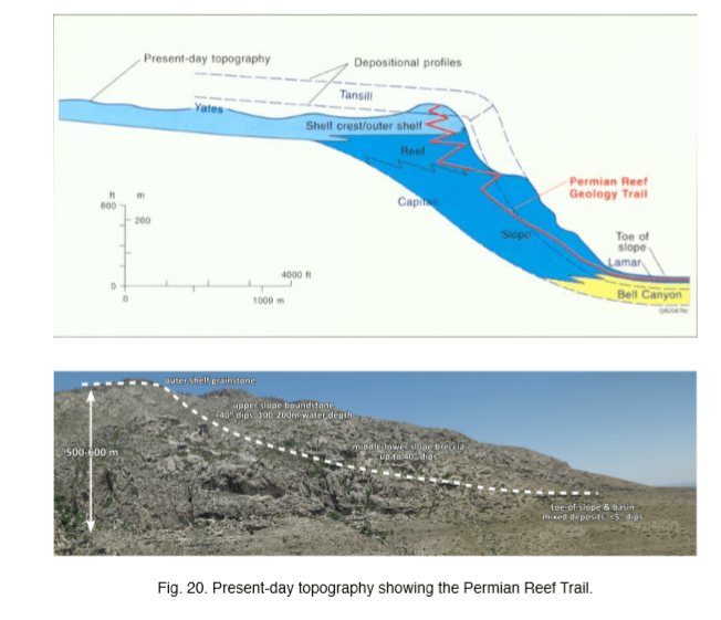
There are several observations right as we begin the Permian Trail that tell us a lot about its history and formation. We know that there was once a riverbed present because the gravel sediments are above the loose stones. Darker conglomerates were most likely caused by lichen weathering. The majority of the formations here are either or a mix of sandstones, siltstones, and siliciclastic grains with a CaCO3 cement. The addition of angular breccia grains can be observed very close to the base of the trail, however the conglomerates disappear and give way to limestone formations. The mudstones present lack allochems (fossils) and are micritic and very fine-grained. The reason these mudstones lack any allochems is because there was a lack of sediment transportation and deposition.
At around 5070 feet the basin shows accumulations of siliciclastic sediments and the lamar limestone formations are present. About 100 feet higher, those lamar limestone bedding planes can be seen interbedded with the Bell Canyon limestones. If you continue climbing, at about 5270 feet, there is a pillar of four different units. They are burrowed with no distinct bedding caused by severe secondary bioturbidity. There are microbeds of wackestone.
As you continue up the trail to about 5400 feet you begin to see dissolution features like Karren in the limestone. There are small undulations without distinct bedding, again due to bioturbation activity. The turbidity currents are carrying and deposition thin layers of micritic wackstone within the limestone. However, now that there is proper transportation of deposition of sediments this wackestone begins to have allochems and other skeletal deposits. There is a transition from the lamar limestone to this skeletal wackstone taking place showing that you are moving up the reef, possibly into areas that go through times of evaporation. There is also bioclastic packstone with algae and nonskeletal grains in them.
There is another distinct change around 5670 feet, where the carbonate muds and mudstones slide down the slope possibly showing that they were once higher up on this slope. Here there were also bioturbated wackstone and grainstones found.
Around 5900 feet we see evidence of the shelf crest/ outer shelf in the form of skeletal siltstones, siliciclastic rocks, and skeletal wackstones. Another important indicator of this change in environment are the sponges and Fusulinida, which are extinct, tiny, single-cell organisms that secreted microgranular calcite. Like many other Foraminifera, they were common in the Guadalupe Mountains and Permian period, so they are often used in dating methods.
The last big observed change occurred at 6130 feet. These were interbedded basal reef deposits and calcite deposits from primary porosity. These observations indicate that this is now the reef and possibly the beginning of the lagoon environment.
Monday September 23, 2019 : Road Stop 7: Castile Formation
Geographic Location: 32° 2′ 31″ N , 104° 28′ 15″ W Elevation: 3850 ft

The Castile Formation formed after the Guadalupian epoch, at the end of the Permian period, during the Ochoan epoch. The lighter layers are evaporite formations mostly gypsum/anhydrite deposits, while the darker layers are carbonate deposits mostly made of organic rich limestone. There is evidence that each couplet of one light and one dark layer represents one annual year. This is because the evaporite layers will form in the warmer seasons when evaporation rates are high leaving behind large amounts of evaporite minerals, while the carbonate layers would form during the winter months when evaporation was slow and more carbonates were being precipitated out of the water.
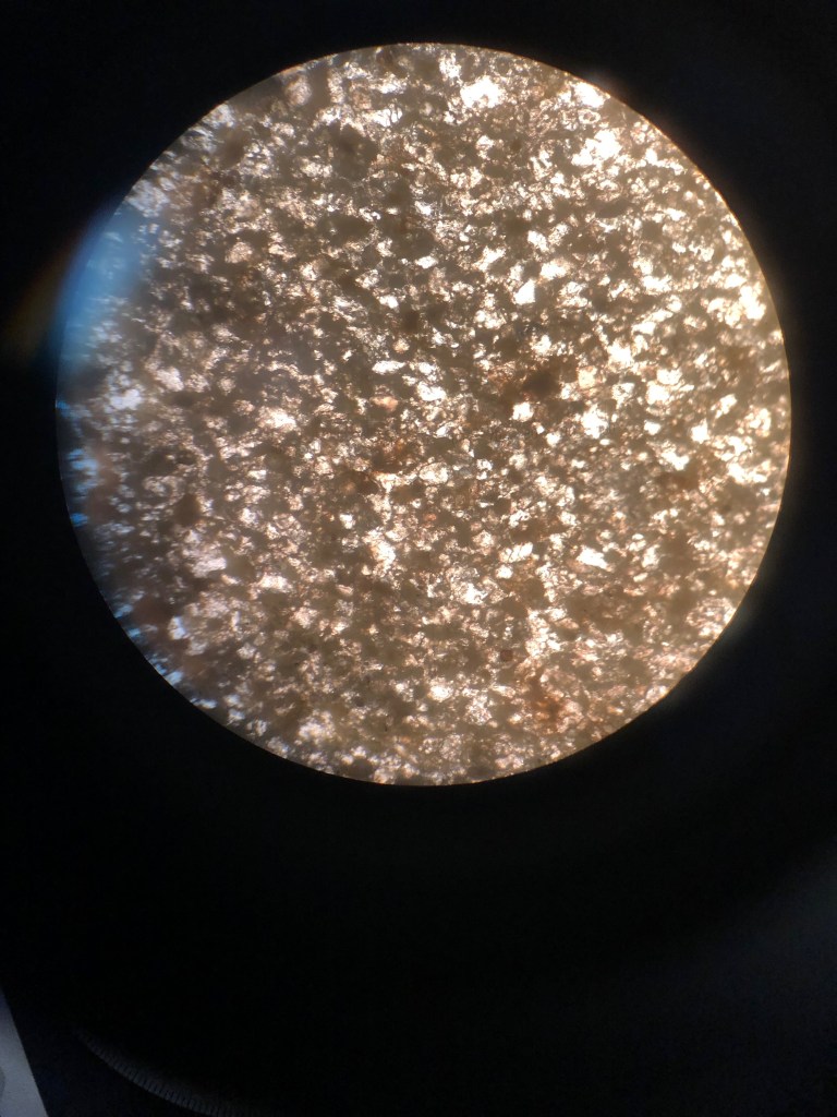
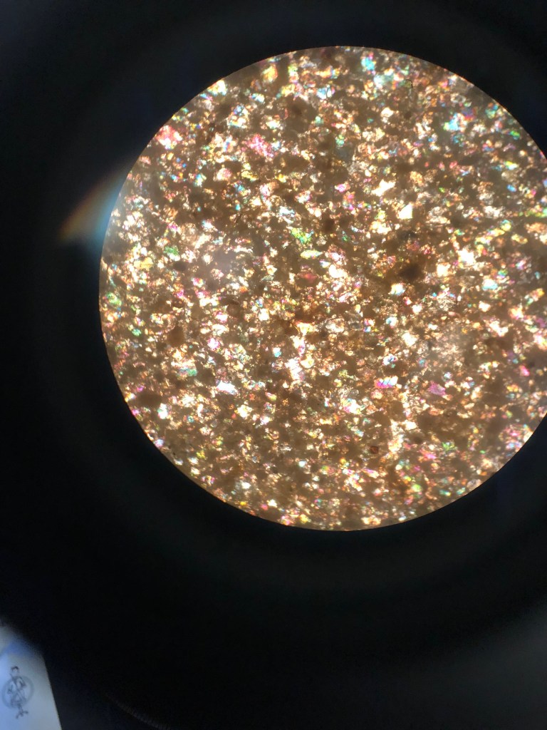
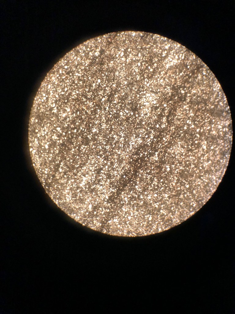
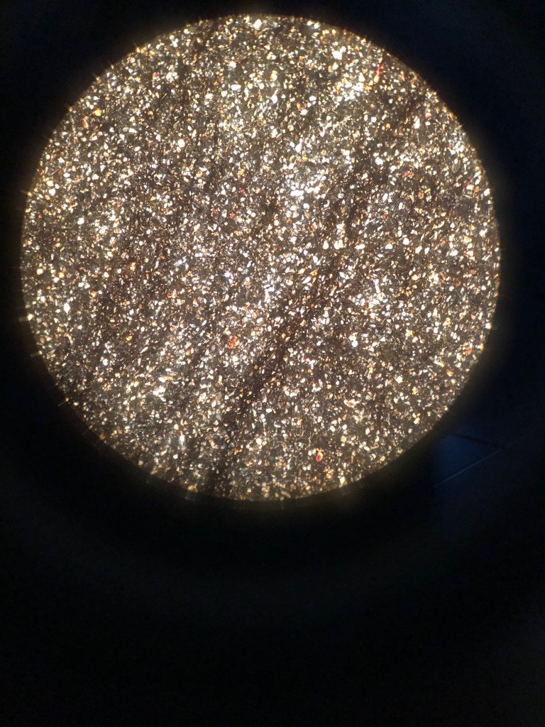
In the above thin section photos, the evaporite minerals such as gypsum, anhydrite, calcite, and even a few small halite crystals can be clearly seen. The pictures also show that these minerals are mostly situated in the light lamina. Also clearly seen under a microscope are the carbonate lamina that are thinner than the evaporite layers. However, in the carbonate layers, the crystals are much smaller than the evaporites and they cannot be clearly distinguished. But the main point of me making these thin sections was to see the evaporite minerals and they are beautiful.
Tuesday September 24, 2019 : Teepee Structures in Carlsbad Caverns Parking Lot
Geographic Location: 32° 10′ 27″ N, 104° 26′ 48″ W Elevation: 4080 ft
These teepees are also known as Yates-Tansill formations. These are small anticline in this region, during this time period. The structures we saw are primarily limestone/dolostone with some sandstone. But they are not fully lithified, meaning they are not completely rock. They formed when a “spring” force pushing up from underneath and broke the continuity of the layers. This force could have been water pushing upward. The holes/pores and small cracks were later filled in with secondary sparite and calcite deposits.
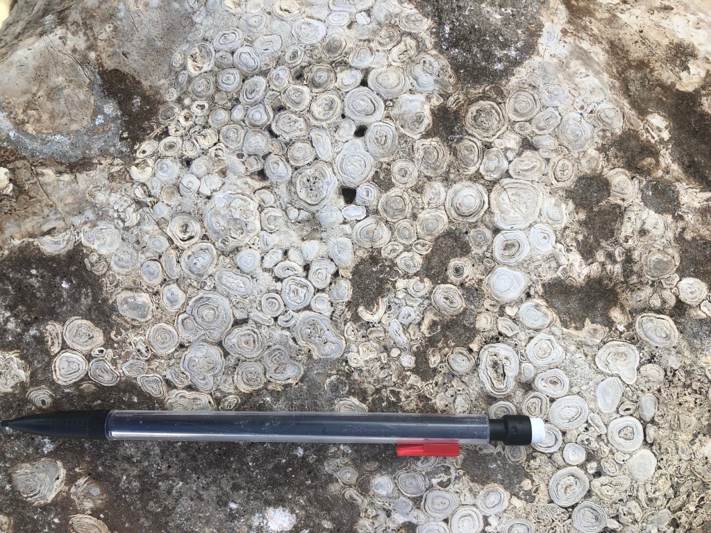
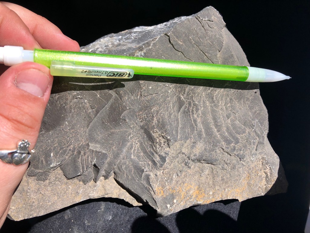
Almost directly next to the teepees structure there are some pisolite rocks that have been cut so that you can easily see the clear concentric structure of the pisoids that comprise the rock.
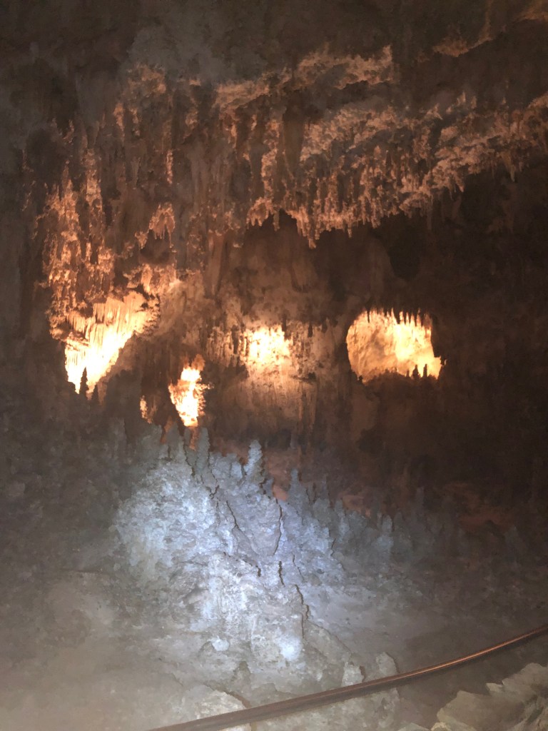
Tuesday, September 24, 2019: Carlsbad Caverns- The Big Room
Geographic Location: 32° 8′ 52″ N , 104° 33′ 24″
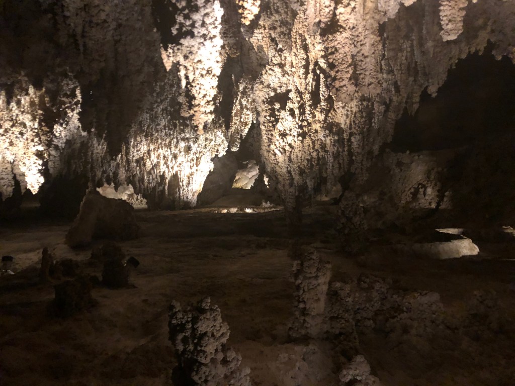
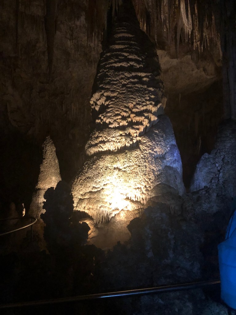
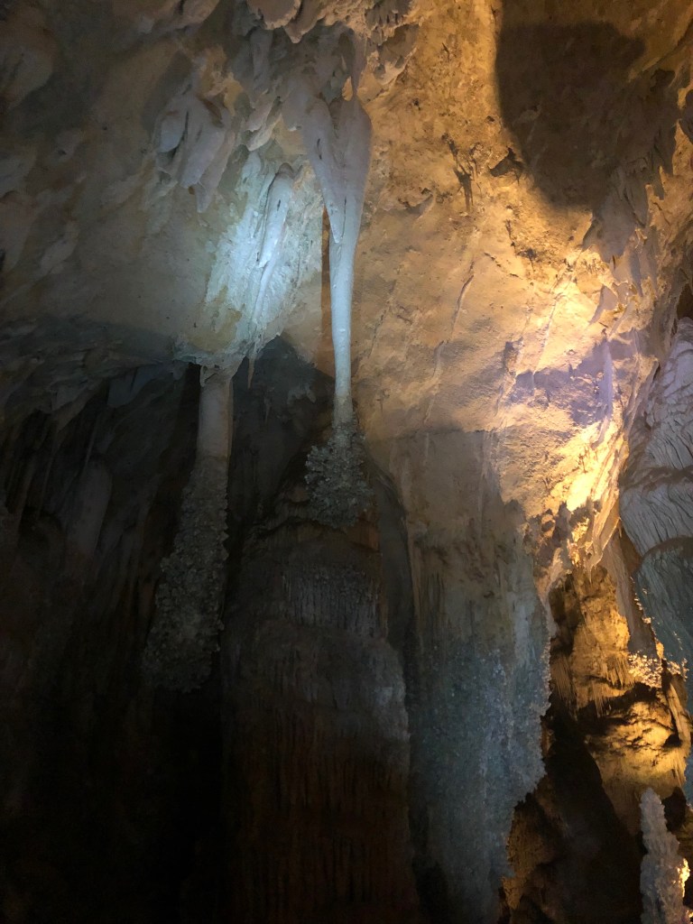
The Carlsbad Caverns are some of the largest, most impressive cave systems that have been explored. Over six kilometers have already been explored inside the caves. The Carlsbad Caverns formed from Hydrogen Sulfide (H2SO4) movement and dissolution rather than fluvially like many karst caves. There are many breccia conglomerates that form from this H2SO4 dissolution. There were visible fossilized mud cracks on the undersides of many rocks. Another main process forming the shape and features in the caves is water dripping that slowly, but constantly dissolves CaCO3 rocks and minerals. Water however, is the secondary formation mechanism as if flows from dams and cracks. Gravity has cause large boulders to collapse. Due to the caverns being located underneath the backreef of the Delaware Basin, the porosity is a direct effect of the reef formations. There are examples are gypsum/anhydrite replacement and formation throughout the entirety of the cave. Some features are caused by water splashing on the walls, perhaps during the gravitational boulder collapses. The H2SO4 dissolution process often replaces CaCO3 with gypsum formations. There are a range of features that show many different processes that are occurring inside the caverns.
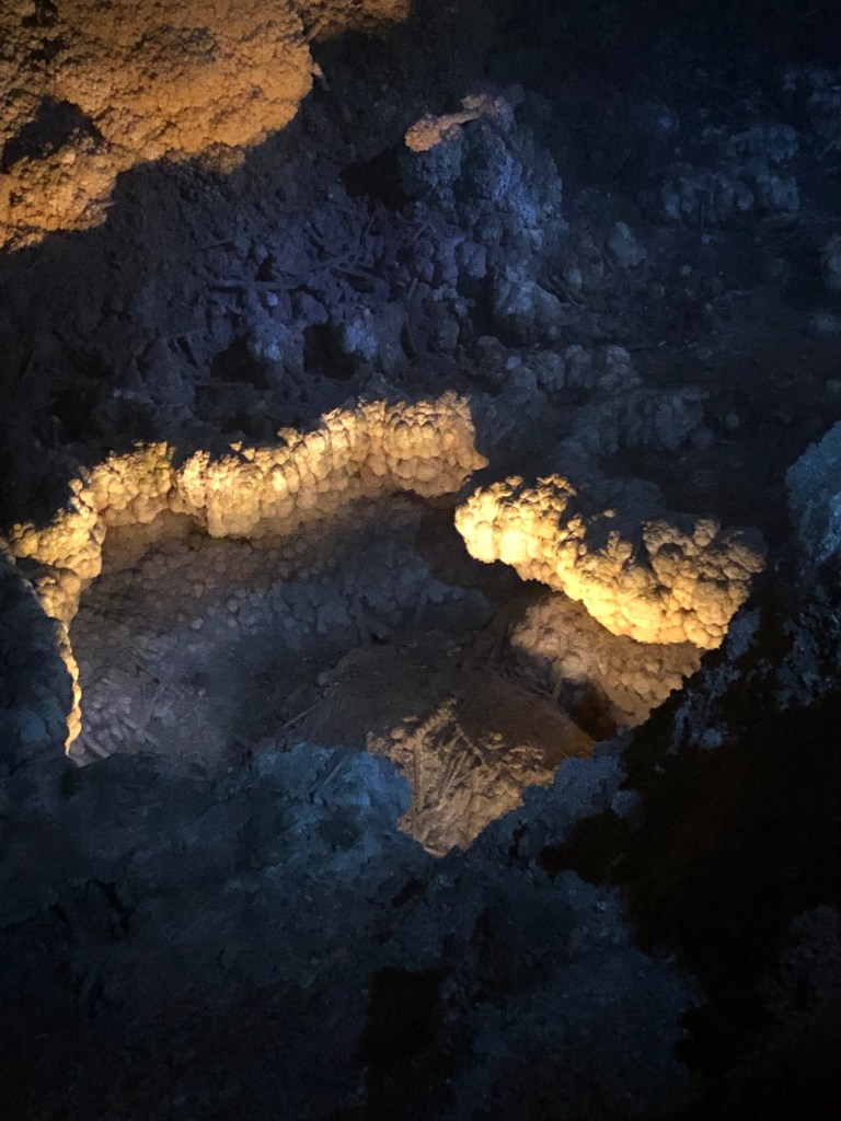
Tuesday, September 24, 2019: Carlsbad Caverns- Lion’s Tail & Popcorn Texture
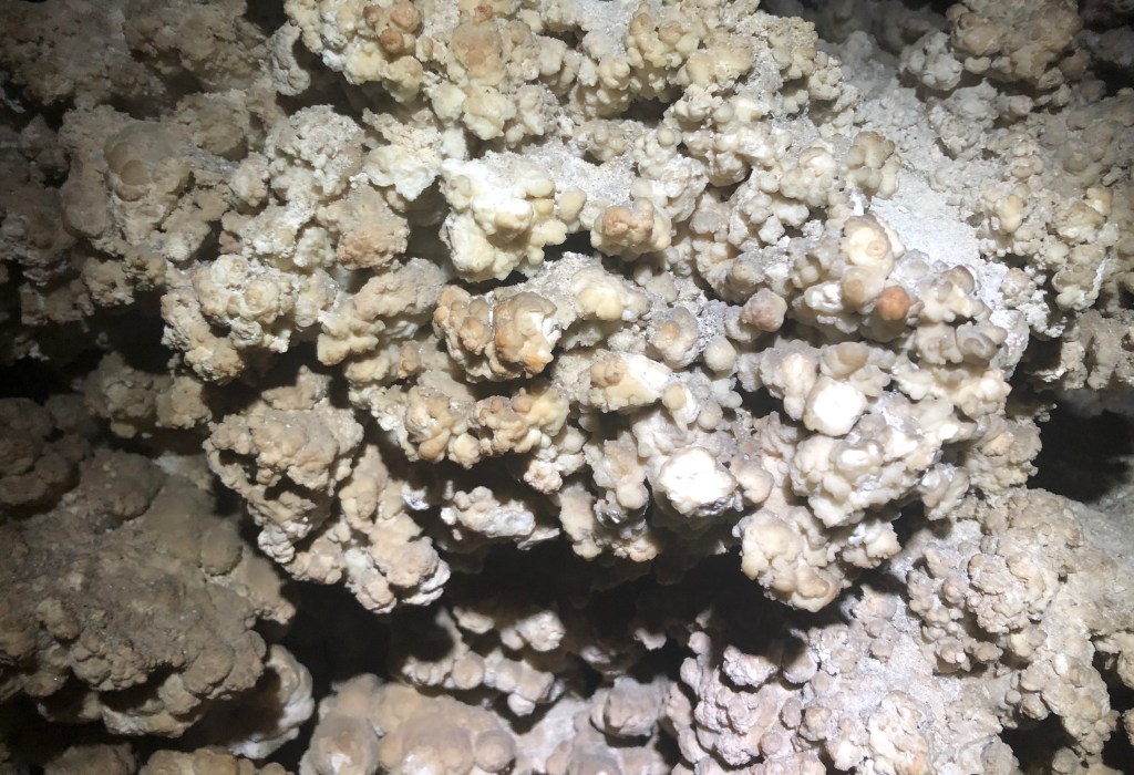
The first picture above shows one type of mineral formation with a texture called popcorn. In the second picture you can see that the popcorn texture stops at a certain point and disappears anywhere above that line. This is due to air ventilation inside the cavern.
There are fossils inside the cave, including shells, ammonites, and trilobites. However, there may be others.
Tuesday, September 24, 2019: Carlsbad Caverns- Bottomless Pits
The Bottomless Pits in Carlsbad Caverns are the main access point for the H2SO4 acid in its gaseous form. These are large, sometimes deep pools with little water. These pits also act as a ventilation system for the caverns, playing a part in determining how high the popcorn texture can form.
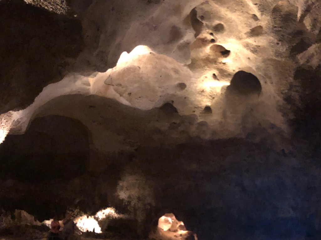
Many times, directly above these access point for H2SO4, there are large cavities on the ceiling from where the gas rose up and began to dissolve the rock.
Tuesday September 24, 2019: Capitan Pisoids
Geographic Location: 32 °11′ 15″N, 104° 25′ 19″ W Elevation: 3880 ft
These pisolite formation are present still inside Carlsbad Caverns National Park, just all the way down the road almost to the exit, They are from the backreef environment of the Delaware Basin, meaning they formed in lagoons and other shallow marine environments. It is not fully explained or decided on why the Capitan Pisolites have reserve grading present but a possible theory is related to water movement. The dark brown-red staining from rust is caused by the presence of iron oxides which indicated that this is a sandstone formation.
We walked a few meters to the south to see a formation caused by a fault moving the rock planes. Since the rock is harder than gypsum with visible cleavage we know that it is calcite forming in the preexisting cracks.
Tuesday September 24, 2019: Neptunian Dike
Geographic Location: 32° 4′ 49″ N, 104° 25′ 24″ W Elevation: 3770 ft
The Neptunian Dike pictured above is not particularly visible with everybody standing around it but it shows the general location of the feature. The Neptunian dike has several cores which is great for providing paleomagnetic information to researchers. The original limestone was cracked open in a “V” shape then the younger material (sediments) filled in the cracks. There is nodular boundstone, more specifically algal boundstone and spongal boundstone.
References
https://en.wikipedia.org/wiki/Cenote
https://www.americansouthwest.net/new_mexico/bottomless-lakes/state-park.html
https://geoinfo.nmt.edu/tour/state/bottomless_lakes/home.html
https://www.sciencedirect.com/topics/earth-and-planetary-sciences/aquitard
https://www.mindat.org/min-90.html
https://en.wikipedia.org/wiki/Fusulinida
-
Featured
My First Blog Post
Be yourself; Everyone else is already taken. — Oscar Wilde. This is the first post on my new blog. I’m just getting this new blog going, so stay tuned for more. Subscribe below to get notified when I post new updates.
-
Introduce Yourself (Example Post)
This is an example post, originally published as part of Blogging University. Enroll in one of our ten programs, and start your blog right. You’re going to publish a post today. Don’t worry about how your blog looks. Don’t worry if you haven’t given it a name yet, or you’re feeling overwhelmed. Just click the… Read more
Follow My Blog
Get new content delivered directly to your inbox.
